Follow Us x
Loneliest Road
The Loneliest Road in America
In Nevada, US Highway 50 is known as the "Loneliest Road in America" a name it earned due to its long stretches with little or no services. It is routed along the old Lincoln Highway and the path of the Pony Express. It passes through the towns of Stateline, Carson City, Moundhouse, Dayton, Stagecoach, Silver Springs, Fallon, Austin, Eureka and Ely. It becomes multiplexed with U.S Route 6 at Ely, and enters Utah 150 miles east of Ely. The only services directly on U.S. 50 between Ely and Delta, UT is the Desert Inn at the state border, about equidistant between Ely and Delta.
Traveling US Highway 50, Nevada
The view from Great Basin National Park is tremendous. The main attractions include the Lehman Caves, Wheeler Peak and Lexington Arch. Wheeler Peak is in the 13,000 feet range. Pure white snow covers the upper third of this impressive mountain. There is no pollution in this area and the air is dry and clean.
US 50 roughly follows the path of the Pony Express riders. This famed mail route included places such as Baker, Ely, Eureka, Austin, Fallon, Silver Springs and on to Sacramento. Brave young men carried mail between St. Joseph, Missouri, and Sacramento, California. To become a rider, the requirement was for "young, skinny, wiry fellow not over eighteen. Must be expert rider willing to risk death daily. Orphans preferred." It took 10 days for a letter to travel the entire 1,800 miles of the Pony Express route.
In Ely, do not miss the opportunity to stay at Cave Lake State Park. The park is at an elevation of 7,300 feet and surrounded by snow-peaked mountains. The camp sites and picnic areas are on a hill among trees adjacent to a small lake.
We'll try to conquer "The Loneliest Road in America" from Ely to Carson City. It's approximately 300 miles. The first city after Ely is Eureka, about 77 miles away. For this reason, we will have a good breakfast in Ely. Jerry's promises to serve the best pancakes with eggs, sausages and coffee. We also visit the Nevada Northern Railroad. It's an old railroad company that is still in existence, but now only serves the tourists. They have an old steam engine, a depot and all the old equipment. So for the railroad buffs, this might be a winner.
It is time to say good-bye to Route 6. We have shared the road with US 6 from Delta, Utah. US 6 will continue on to Long Beach, California. US 6 started its journey in Provincetown, Massachusetts.
The historic Lincoln Highway runs from New York to California. In Nevada it followed US 50 from Ely to the beautiful south shore of Lake Tahoe.
*Eureka!* a miner is said to have exclaimed in September of 1864, when the discovery of rich ore was made here. And so the town was named. Eureka soon developed the first important lead silver deposits in the nation and during the furious boom of the 80s, had 16 smelters, over 100 saloons, a population of 10,000, and a railroad. By 1878 Eureka was the state's second largest city. Today, Eureka has become a small town on Route 50. It has a colorful past and is proud of its history. If you want to know more about the history, go across the street to the Eureka Opera House and talk to Wally Cushin. He's the director, but he is also a historian. The Colonnade Hotel has a new owner and is currently being restored. This historic 10-room hotel was built in the 1880's.
Next town along the route is Austin. It is an old mining town. On Main Street, the International Hotel serves breakfast, lunch and dinner, and proclaims to be the Last Chance Saloon before one leaves town on the journey that will have 110 miles of desert.
The road stretch between Austin and Fallon is the most isolated of the three we are traveling. Very seldom do we meet an oncoming vehicle and there is virtually nothing along the road. We stop at the "Pony Express Cold Springs Station" to cool of and talk. Next stop is Middlegate Station. Today, it is a bar, a waterhole. It's an interesting stop for picture taking and talking.
Fallon is called the "Oasis of Nevada." Names in this town point to its rich heritage which is cattle, stockyards and mining. The road I walk is called Auction Road. I just parked at the back of a place called the Stockmen's Restaurant and Casino. Fallon is a booming town; it is not an isolated town as we had seen at Austin, Eureka and Ely. Those were frontier mining towns. Fallon has farming, cattle, commerce, the Navy Air Base and entertainment.
Silver Springs is situated at the junction of US Alt50/Alt95 and US 50. It's a small community consisting mostly of trailer homes, a gas station, a liquor store and a general store. It is interesting that the junction of these two major arteries is a four-way stop. This traffic arrangement is very common here and works well. For the record, we did not stop at Break A Heart Saloon.
The next town we reach is Dayton, one of Nevada's oldest communities. Dayton emerged a a trading post in 1849. We drive up to the Dayton cemetery. It was founded in 1851 and it's still used today. It is one of the oldest cemeteries that has been continuously used for such a long period of time. There are a lot of young children under the age of 1-year that died and are buried here, which testifies to the ruggedness of living in those days. Now, here is a grave dedicated in 1981, but let me read to you what it says. "Old Virgini. James Fennimore - 1810-1865. One night when he was dead drunk, some men took him to the cemetery and dug a shallow grave. They left him there. About daylight, he awoke and raising up in the grave, looked around and called out, 'The resurrection morning, and I'm the first one up'."
Since we are from Virginia, we must visit the city named by James Finney, nicknamed "Old Virginny," in remembrance of his birthplace. From Silver City, we take the old route to Virginia City. It's very curvy and we encounter steep hills. It's worth the drive if you like to see old mining country.
Next stop is Carson City, Nevada's state capitol. As the saying goes in Nevada, "public business is ruled by the two large cities, Reno and Las Vegas". And Carson City is prospering by the money to run the state. We are proud, we have completed driving The Loneliest Road in America. We visit the state capitol with its silver dome. The first thing we notice is the open-door policy. We can view the office of the lieutenant governor or the secretary of state and can immediately have contact with the governor's secretary. In the cities out west, crime has not escalated to the point where every person has to be behind a security fence to assure safety.
As we come down from the Spooner Summit through the tall pine forest, Lake Tahoe emerges among the trees. The lake lies majestically in this basin. At Logan Shoals Vista Point, we stopped and looked at the lake. It's a beautiful place to take pictures and see the magnificent colors in the water. State Line allows gambling and has the casinos.
Copyright 2002 W. Berg Press
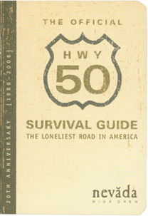
Will You Survive 'The Loneliest Road in America?'
By Richard Moreno
The road before me was empty. The road behind me was empty. In the sky, the setting sun cast an orange glow that made the clouds look like huge cotton balls soaked in iodine. I was beginning to understand why this was called the Loneliest Road in America.
In July 1986, Life magazine described Nevada's U.S. Highway 50 from Ely to Fernley as the "loneliest road" in America. Life said there were no attractions or points of interest along the 287-mile stretch of road and recommended that drivers have survival skills to travel the route.
The communities along the desolate route decided not to get mad, they got even and developed a tongue-in-cheek "Highway 50 Survival Kit." The kit contained brochures and maps detailing places along the route and a special Highway 50 passport, which travelers can have validated in the five largest communities (Ely, Eureka, Austin, Fallon and Fernley). Validated maps are redeemed for a Highway 50 pin, postcard and a "Silver State Survivor" certificate signed by the governor.
Additionally, the Nevada State Legislature authorized "Loneliest Road in America" road signs to be erected along the route.
Since then, Highway 50 has been featured on television and in newspapers and magazines across the country. Thousands of Highway 50 Survival Kits have been distributed and traffic counts show the road isn't quite as lonely as it used to be. In fact, travelers are discovering that it is one of the most historic and scenic routes in the West.
The road roughly parallels the trail blazed a century ago by brave, tough Pony Express riders. Later, Highway 50 was part of the original Lincoln Highway, the first intercontinental road in the United States. Stretching the width of Nevada, U.S. 50 is a path through places seemingly untouched by man.
It's country where the watch-out-for-cattle signs far outnumber pedestrian-crossing warnings. Cowboys here are the real deal; there's dust on their boots, sweat stains on their hat bands and a distinct bovine bouquet on their clothes.
Starting at the Utah-Nevada border, the traveler heading west on Highway 50 crosses Snake Valley, one of the many elongated basins that stretch from north to south across the state.
Nevada and much of the West are part of the region known as the Great Basin. Thousands of years ago, the area was beneath a huge prehistoric inland sea. Over the centuries, geologic activity pushed massive mountain ranges to the surface and formed the now familiar Nevada landscape.
Looming ahead is impressive Wheeler Peak, the crown jewel of Great Basin National Park. Within the park, visitors will find the intriguing Lehman Caves, an extensive series of fascinating limestone caverns at the base of Wheeler Peak. The park is home of several of the West's largest and oldest groves of bristlecone pines. These gnarled trees, the oldest living things on Earth, can grow in the most inhospitable of climates. Many in the park are more than 3,000 years old.
About an hour from the park is Ely, a historic copper mining town that is home of the Nevada Northern Railway Museum, known as one of the country's best preserved shortline railroads. The museum in the historic Nevada Northern Railway depot and maintenance yard displays a complete operating turn-of-the-century railroad, which originally was used to transport copper ore from the nearby mines to out-of-state smelters. Rides on the vintage equipment are available throughout the year as the "Ghost Train" takes visitors around the hills above Ely.
The road between Ely and Eureka - some 77 miles long - affords some of Nevada's unique high desert scenery. It is open range, so watch for roaming cattle.
The open road offers time for introspection. Yellow road markings seem to stretch for an eternity. At night, the air is so pure that a car radio can receive signals from seven western states and Mexico. Sometimes you see no other traffic in either direction. Out here, one can begin to comprehend the loneliness of the cowboy searching for strays or the Pony Express rider galloping into the unknown.
Ahead is Eureka, perhaps Nevada's best-preserved example of a 19th century mining town. It's a great place to explore, with fascinating ruins and beautifully restored historic buildings, including the Eureka County Courthouse, built in 1879, the Eureka Sentinel newspaper building, now a museum, and the restored Eureka Opera House.
The town boasts a large number of authentic frontier cemeteries that make for an interesting visit. Travelers also will find plenty of services and accommodations.
About 45 miles west of Eureka is Hickison Summit, the site of rare Indian petroglyphs. While no one is quite sure how to interpret them, petroglyphs are ancient Indian rock writing that appear to represent significant events and activities, such as hunting and harvesting.
The next stop is Austin, another former mining town that still claims three of the loveliest frontier churches in the West, several cemeteries and a number of historic structures and ruins. A century ago, Austin was one of Nevada's largest communities with more than 8,000 residents. Today, it offers a handful of accommodations, services and restaurants.
At the east end of Austin is the restored Gridley Store, built more than a century ago. At the west end of town, overlooking the adjacent Reese River Valley, is Stokes Castle, an architectural oddity built in 1897 by an eccentric millionaire to resemble a three-story Roman Villa. From Austin, it is a two-hour drive to Fallon.
Along the way are the ruins of several Pony Express and Overland Stage stations. The best preserved are the stone ruins at Cold Springs and near Sand Mountain. The latter is an unusual 600-foot mountain of sand that stretches for two miles. The giant dune, a popular recreation spot for off-road vehicles, was created by wind-blown sand from the beaches of the prehistoric sea that once covered Nevada.
About 15 minutes from Fallon is another Indian petroglyph site at Grimes Point. An interpretive trail leads through the writings. Adjacent to the petroglyphs is Hidden Cave, an archeological site that has yielded important artifacts that tell the story of Nevada's earliest inhabitants. The cave is open to guided tours that can be scheduled through the Churchill County Museum in Fallon.
The region is famous for its "Hearts of Gold" cantaloupes, known to be the sweetest, juiciest cantaloupes and only available for a short time around Labor Day. Locals know how tasty they are and snatch up the stock quickly. Visitors can find numerous lodging choices and other services in Fallon.
The Churchill County Museum in Fallon is one of the finest rural museums in the state. Inside, the museum offers exhibits describing the trip across Nevada by covered wagon. (Fallon was on the Emigrant Trail at the end of the dreaded "40 Mile Desert.")
A half-hour from Fallon is the Lahontan Reservoir, which offers a full range of water sports, fishing, boating and camping. Completed in 1915, the reservoir is part of the Newlands Irrigation Project, the nation's first federal reclamation project.
An interesting side trip just south of the loneliest road, on U.S. 95, is historic Fort Churchill. The facility was built in 1861 as a garrison for federal troops during the Civil War and to protect the citizens of the state from hostile Indian attacks. Today, the worn clay walls of the buildings that once housed dozens of troops are picturesque reminders of the past. Best time of day to visit the area is late afternoon when the sun is low and the shadows give greater dimension to the ruins.
About a half-hour from Fort Churchill is Fernley, the western gateway to the Loneliest Road. riginally an important agricultural center and railroad station, Fernley has evolved into a fast growing city that offers plenty of services for road travelers on either Highway 50 or Interstate 80.
As I turned from Highway 50 onto busy Interstate 80, I was struck by the differences. Highway 50 was more leisurely. If Interstate 80 could be described as a sprint, than Highway 50 is a casual jog. I accelerated to keep pace with the other cars. Lonely no more.
Click here to request your Official Highway 50 Survival Kit